We’ve had a technical glitch with Ask Jeff…sorry.
My apologies, if you have written to “ask Jeff” it has not worked
Monday, Jun 15th, 2009 by jeffrey | 0 Comments
Filed under: Jeff's Comments
Photo album of Flying the North Atlantic
Friday, May 29th, 2009 by jeffrey | 0 Comments
Filed under: Jeff's Comments
May 15th Wick, Scotland to Leeds, England
Wednesday, May 27th, 2009 by jeffrey | 2 Comments
Wick was lovely and the flight to Leeds, England was 100% in IMC and the Cessna Dealer at Leeds was exceedingly unhelpful…they would not fix our Garmin nor change our oil and they knew we were coming for days. Just that day we spoke to them twice from the satellite phone on the way from Wick, Scotland and they said their engineer would meet us. That he did, to tell us he could not help us for a week.

Andrew at Wick, Scotland the FBO and customs ofWick, Scotland Airport

Wick, Scotland towerWick, Scotland tower
The name of this worthless Cessna dealer is MultiFlight. I would stay way clear of them, they showed us no courtesy after flying across the North Atlantic and flying to their field with bad navigation equipment at 200′ minimums.
We wound up having to fly to Prestwick, Scotland for our oil change…again in the IMC. I was so pissed that I ran up my engine facing their office and hangar…it was the least I could do.
This flight took 1 hours 25 minutes and the distance was 142 NM or 163 miles. The entire flight was IMC.
Because we did not have navigational data, nor a dependable navigational system we cut our trip to Europe short and headed home.
Filed under: Spidertracks Descriptions
May 14th Keflavik, Iceland to Wick, Scotland
Wednesday, May 27th, 2009 by jeffrey | 0 Comments
This leg of the journey presented several problems. We refueled in 45 knot gusts, Miss Behavin’ was dancing in the wind. The take off was in the same winds a harrowing experience. Then we had a small problem of 56 knot headwinds on our way to Scotland…these were opposite of prevailing winds to the east…oh well!
This leg of our journey was 650 NM or 747 miles. It took us 5 hours 58 minutes.

View of the village at Keflavik

View outside my hotel window.

The sea outside Keflavic with white caps from the wind

More Iceland coast

View outside a Keflavic restaurant, great fish.

picture looking out 2 windows of my hotel.

Hotel Lobby

A neat church built like an anchor

A huge dry dock for ship repair

East side of Greenland about to head over the water

East side of Greenland about to head over the water

East side of Greenland about to head over the water

East side of Greenland about to head over the water

Glacier on East side of Greenland

Glacier on East side of Greenland

Glacier on East side of Greenland

Glacier on East side of Greenland
Filed under: Spidertracks Descriptions
May 12th crossing Greenland West to East on the way to Iceland
Tuesday, May 26th, 2009 by jeffrey | 1 Comments
These pictures are of the southern polar ice cap in Greenland. This leg of the journey was 649 NM or 746 miles and it took us 4 hours and 46 minutes to fly.

Taking off out of Narsarsuaq, Greenland

Taking off out of Narsarsuaq, Greenland

Crossing Greenland's Polar Ice Cap on the way to Iceland

Crossing Greenland's Polar Ice Cap on the way to Iceland

Crossing Greenland's Polar Ice Cap on the way to Iceland

Crossing Greenland's Polar Ice Cap on the way to Iceland

Crossing Greenland's Polar Ice Cap on the way to Iceland

Crossing Greenland's Polar Ice Cap on the way to Iceland

Crossing Greenland's Polar Ice Cap on the way to Iceland
Filed under: Spidertracks Descriptions
May 12th Narsarsuaq, Greenland to Keflavic, Iceland
Tuesday, May 26th, 2009 by jeffrey | 0 Comments
Leaving Greenland took us into a winter wonderland of glaciers, mountains, rivers and snow. We filled up at almost $20 per gallon, I donned my immersion suit and off to cross the polar ice cap we went.
The pictures below tell the tale except for the landing in Kevlavik which was accomplished in 45-60 knot winds on a crosswind landing…it was very freaky to say the least. Even the German air force C160’s and a Lear Jet found it quite formidable. It was so windy that we didn’t even refuel that night. Nor could we leave the next day due to wind…the German Air force didn’t leave either.
I almost got blown into the right side landing lights by the time I touched down. It was tough!
Now enjoy all of the pictures below…
First the Greenlanders fill our plane, next I put on my immersion suit, there are pictures of the gorge I landed in, the rescue helicopter, and then vistas of the polar ice cap.

Re-fueling Miss Behavin' in Narsarsuaq, Greenland

Filing flight plan and getting weather in Narsarsuaq, Greenland

Filing flight plan and getting weather in Narsarsuaq, Greenland

Another view of flight service in Narsarsuaq, Greenland

Rescue helicopter Narsarsuaq, Greenland

Panoramic view of gorge I landed in at Narsarsuaq, Greenland

Panoramic view of gorge I landed in at Narsarsuaq, Greenland

Panoramic view of gorge I landed in at Narsarsuaq, Greenland


Panoramic view of gorge I landed in at Narsarsuaq, Greenland


Panoramic view of gorge I landed in at Narsarsuaq, Greenland

Panoramic view of Narsarsuaq, Greenland

Panoramic view of gorge I landed in at Narsarsuaq, Greenland

Panoramic view of gorge I landed in at Narsarsuaq, Greenland

Panoramic view of gorge I landed in at Narsarsuaq, Greenland

Rescue helicopter at Narsarsuaq, Greenland

Jeff struggling into immersion suit while Don laughs

Don waiting to board the plane for flight to Keflavik, Iceland

Jeff struggling into immersion suit while Don laughs

Jeff struggling into immersion suit while Don laughs
Filed under: Spidertracks Descriptions
May 12th Goose Bay, Canada to Narsarsuaq, Greenland
Tuesday, May 26th, 2009 by jeffrey | 0 Comments
We spent the night in Goose Bay and ate dinner at one of Don’s favorite restaurants. They give you the steaks that you order and you cook them yourself the way you like it over the indoor barbecue.
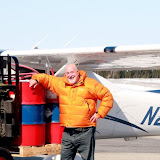
Fueling up in Goose Bay was a challenge as they didn’t have a truck and I had to buy 2 barrels of gas and pump it myself. It made for some good photos.

Preparing to fuel Miss Behavin' from 55 gallon drums at Goose Bay

Woodward Aviation our agent who supplied the fuel in Goose Bay

The tower at Goose Bay, Canada

Getting ready to pump the fuel, oh what fun!

Pumping fuel


This would begin our journey across the North Atlantic to Narsarsuaq, Greenland…a true adventure. Here I would don my immersion suit and double check Miss Behavin’ for the crossing.
Our flight across took 4 hours and 47 minutes of which 2 hours and 10 minutes were in IMC (in the clouds). When we broke out of the clouds we watched about 100 miles of icebergs and ice flows…these were indescribable and my camera failed…what a shame.
The distance of this leg was 674 NM or 775 miles.
The landing was amazing. Normally you land from the water uphill facing the glacier this time we had to fly into the gorge turn a 50 degree right base leg turn not to hit the other side of the gorge, land downhill on only 900 meters of a 1900 meter runway as they were doing repairs. For those of you who are pilots you know in landing configuration you should not do more than a 30 degree bank. This was a real trick landing…kinda bush pilot.
Filed under: Spidertracks Descriptions
May 11th Bangor, Maine to Goose Bay, Canada
Tuesday, May 26th, 2009 by jeffrey | 0 Comments
Don and I spent the night in Bangor, Maine and left early in the morning for Goose Bay, Canada. We were struck by the snow building on the ground as we headed north and we were also struck by the lack of trees due to Canadian logging operations. We could see some areas where they had replanted trees…it would be a long time before they matured.
This leg of the journey was 607 NM or 698 miles. The flight took4 hours and 24 minutes.
When we landed I was shocked at how cold it was in Goose Bay. We could definetly tell we were way north.
Filed under: Spidertracks Descriptions
May 10th Mt. Pleasant, SC to Bangor, Maine
Tuesday, May 26th, 2009 by jeffrey | 0 Comments
Now I’ve picked up my ferry pilot Don Ratliff and we are on our way. First stop Bangor, Maine.
We chose to fly VFR (visual flight rules) at 11,500′ all the way direct to Bangor. We had a beautiful flight. After dodging to the East to miss the Washington, DC flight restricted area we headed up the Cheasapeke Bay across the Delaware Bay East of Cape May, New Jersey.
Flying about 10 miles off the coast the view of the Jersey shore was beautiful and brought back old memories.
Approaching New York City about 15 miles east in the Atlantic was a lovely sight, then as I turned Miss Behavin’ across Long Island to move west of the Boston B class air space I received a call from JFK’s approach. Apparently we were crossing JFK’s ILS approach space. I looked over at Don and he was asleep. I asked JFK if they wanted me to make any changes to my flight path. They said no, that they would route the heavies (large aircraft) around me.
After dodging about 20 737’s, 747’s and other type heavy aircraft Don awoke and asked what was going on. I told him, as we both watch with amazement dodging another 20 or so large aircraft. They were 500 feet above us a 1000 feet below us, 3 o’clock at 1 mile, etc. It was invigorating and thrilling. Usually a controller would change our route. I’ve always been told that the New York controllers were a tough lot…but no such situation this time.
The rest of this leg was uneventful and easy. I was blown away by just how beautiful Maine’s landscape is…full of lakes and beauty.
This leg took six hours and three minutes to fly. It was a distance of 877 NM or 1009 miles.
We were definetly on our way!
Filed under: Spidertracks Descriptions
May 9th KPNE to KLRO Mt. Pleasant, South Carolina to pick up Don Ratliff
Monday, May 25th, 2009 by jeffrey | 0 Comments
Well rested after spending 2 nights at the Ritz Carlton across from Philadelphia’s city hall facing the William Penn statue at it’s top, I left late morning to pick up Don Ratliff.
It was a beautiful sun shiny day, I felt invigorated and ready to commence the major part of my journey.
It was a 458 NM journey or 526 miles for you land lubbers. It took me 4 hours 30 minutes.
Don was waiting at the airport…not my best landing…and we immediately fueled Miss Behavin’ and attached our High Frequency (HF) radio antenna and hooked up the radio. I had pre-wired the bus of the plane for a 20 amp 3 foot wire to power the radio. The addition of an HF radio is a requirement for crossing the North Atlantic as you lose normal radio contact from time to time. Don was a real pro, it took him about 20 minutes to rig the whole thing, then we were off to my hotel.
Later that night Don and his lovely girlfriend Sally took me into Charleston. First we toasted with a drink that Don concocted and then we were off to a fine meal at a local restaurant.
We both had a nice sleep, Don said goodbye to Sally in the a.m. and we were off early morning for Bangor, Maine.
Filed under: Spidertracks Descriptions